Overview of the Surveys for Mapping :
Prince Charles Mountains, 1954-1974
Mapping surveys in the Prince Charles Mountains region of Antarctica is summarised by John Manning in his 2012 paper Mapping Surveys in the Prince Charles Mountains of Antarctica. Since then other papers on these surveys have emerged and possibly other papers might emerge in the future. To provide a simple, logical context for these more detailed documents and maps showing the extent of these surveys, the following overview has been compiled. While every effort has been made to ensure accuracy readily available records are not always concise as to when events occurred. Nevertheless, most events are listed according to when they first occurred based on National Mapping’s Antarctica Trigonometrical Station Summaries and for the 1969/70 and 1971/72 Antarctica field seasons, Natmap technical officer Ed Burke generously provided access to his diary entries.
The Astrofix Era
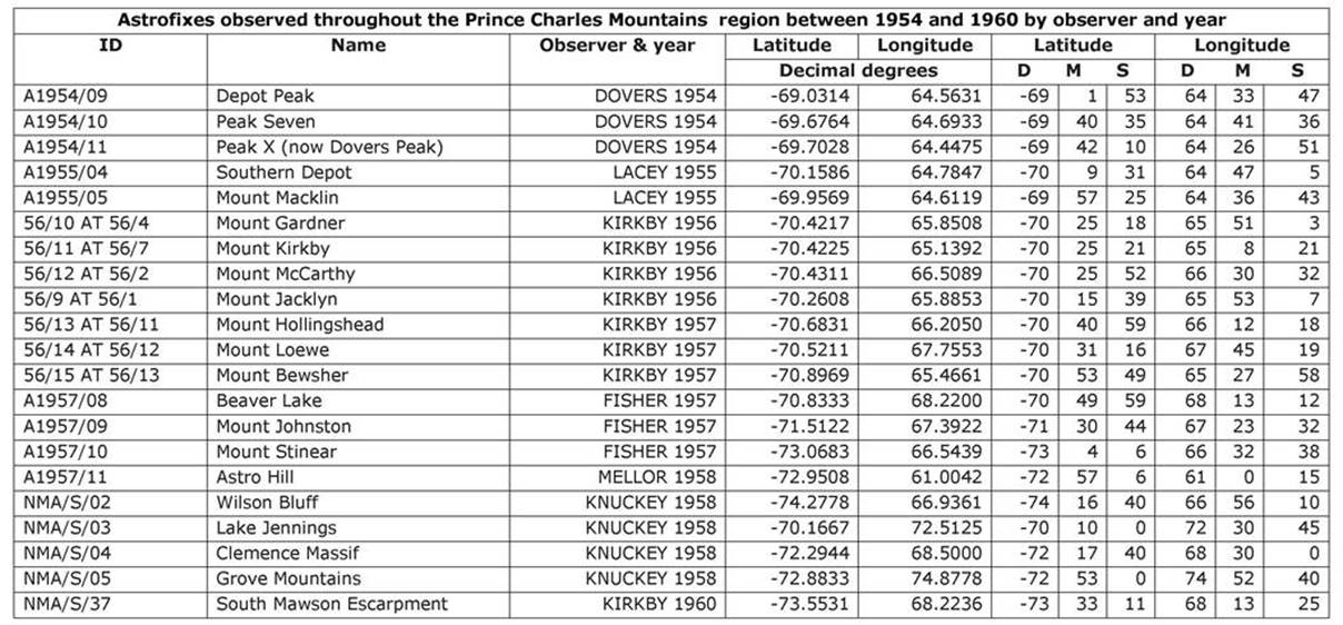
In 1954 Surveyor Robert Dovers in his journal confirmed the presence of mountains in the southern region of the Australian Antarctic Territory. These mountains were later named after His Royal Highness, Prince Charles, heir apparent to the British Throne, who was born in November 1948. Between 1954 and 1960 astrofixes were observed throughout the Prince Charles Mountains region. Commencing at Depot Peak in the north, astrofixes were observed as far south as Wilson Bluff and from the Goodspeed Nunataks in the west to Jennings Lake and the Grove Mountains in the east. The table below lists these astrofixes by observer and year as extracted from the relevant Station Summaries. The extent of these astrofix surveys is shown in the map at Figure 1.
Amery Ice Shelf Glaciology
As will be described further on, as the geodetic survey through the Prince Charles Mountains progressed connections were made to the then sites of the Amery Ice Shelf 1968-70 glaciological survey traverses, generally identified as at T1, T2 and T4. Glaciological work on the Amery Ice Shelf was initially established in 1963/64 following Carstens’ work and general reconnaissance on the ice shelf in the summer of 1962/63. Progressive studies of the ice shelf's properties were then undertaken and papers detailing these initial Amery Ice Shelf programs and studies, as well as a summary of this work by Max Corry, may be found via this link.
Essentially, in the summer of 1963/64 a line of stakes at about 2 mile intervals down the shelf’s centreline was established for some 125 miles. Near the northern and southern ends of the centreline lateral lines of stakes of some 60 miles and 40 miles length, were emplaced. Position line astrofixes and sun azimuths for orientation were observed at specific locations. In the summer of 1964/65 reobservation of the centreline astrofixes allowed information about the ice shelf’s movements to be derived. During 1968-1970, to gain information about the ice shelf’s internal and external environment, traverses generally following the route of the centreline and the two transverse arms were marked and surveyed using then state-of-the-art material and equipment. The 88 sites of the Amery Ice Shelf 1968-1970 glaciological survey traverses are depicted by the dots in the map at Figure 2. Tellurometer connections to the Amery Ice Shelf 1968-70 glaciological survey traverse sites named above, from the completed Mawson-Davis geodetic traverse, then provided a fixed stable reference for the moving survey points on the Amery Ice Shelf.
Traversing by Theodolite and Tellurometer
By early 1966 the geodetic survey had been extended, as described in this report by Corry, from Mawson to Depot Peak (NM/S/116). As an independent check on this survey was not available and with the degree of ice movement at the various 1965 ice stations being unknown, after a reestablishment of the geodetic origin for Australian Antarctic surveys the Framnes Mountains to Depot Peak survey was repeated in 1967 as described in this paper by Manning. In the meantime, in the summer of 1966/67, the geodetic survey had been extended via the ice station Glaciology 1 (NM/S/121) and Peak Seven (NM/S/117) of the Stinear Nunataks, Mount Shaw (NM/S/118) and Mount Lacey (NM/S/119) to Mount Wishart (NM/S/120). To undertake this work a supply and access route was created, terminating at a depot below Moore Pyramid.
Along the traverse route lower order survey points at Mount Bechervaise (NM/S/132), Gowlett Peaks (NM/S/126), Leah Ridge (NM/S/134), Mount Macey (NM/S/127), Riddell Nunatak (NM/S/125), Mount Seedsman (NM/S/131), Mount Starlight (NM/S/133) and Summers Peak (NM/S/124) were established by intersection. Please refer to Figure 3.
For logistical reasons in the summer of 1967/68 geodetic traversing commenced along the Ingrid Christensen coast to the west of Australia’s Davis Station, as reported by Styles. Between Blundell Peak (NM/S/135) to Rubeli Bluff (NM/S/143) in the Reinbolt Hills, the traverse travelled via Mount Caroline Mikkelson (NM/S/136), Hamm Peak (NM/S/137), Landing Bluff (NM/S/138), Vrana Dome (NM/S/140), Smith Ridge (NM/S/141) and Corry Rocks (NM/S/142) at the northern end of Gillock Island. The positions of Nickols Island (NM/S/173), Sansom Island (NM/S/172), Bosun Island (NM/S/171), Spayd Island (NM/S/167) and the Statler Hills (NM/S/170), were fixed from intersection observations. Please refer to Figure 4.
McKinnon reported that at the beginning of 1969 the geodetic survey recommenced at the Reinbolt Hills station of Rubeli Bluff (NM/S/143). The survey then travelled along the edge of the Amery Ice Shelf south to Mousinho Rock (NM/S/144) and New Year Nunatak (NM/S/145) to Pickering Nunatak (NM/S/146). A 69 mile line was then observed across the Lambert Glacier to Blustery Cliff (NM/S/147) on the Fisher Massif. Travelling north west via Fox Ridge (NM/S/148) and Mount McCarthy (NM/S/149) the survey closed at the 1966 survey terminal of Mount Wishart (NM/S/120). During this section of the traverse, connections were made to Else Platform (NM/S/156) and sites T2 and T4 on the southern end of the Amery Ice Shelf glaciological survey traverses. With the additional connection between Landing Bluff (NM/S/138) and T1 (now sited further to the east as the original T1 site was never relocated, assumed buried) on the eastern transverse of the Amery Ice Shelf glaciological survey traverses, these traverses were now rigidly controlled.
In the region of Mount McCarthy lower order survey points at Mount Abbs (NM/S/160), Mount Bunt (NM/S/159), Mount Jacklyn (NM/S/158), Mount Lied (NM/S/155), Mount Loewe (NM/S/164), Martin Ridge (NM/S/163), O'Shea Peak (NM/S/161), Mount Sundberg (NM/S/162) and Mount Stalker (NM/S/157) were established by intersection. Please refer to Figure 5.
The geodetic survey was then completed in the east from the Larsemann Hills to the Vestfold Hills in the vicinity of Davis Station via survey stations at Blundell Peak (NM/S/135), on the ice at the aptly named Ice Station (NM/S/152) near Amanda Bay, and then Fila Island (NM/S/153) to Tarbuck Crag (NM/S/154). Connections were made to Cowell Island (NM/S/151), and a rock near the then Amanda Glacier, now officially the Dalk Glacier. Anchorage Island and Hawker Island offshore from Davis, were fixed by intersection. Please refer to Figure 6.
The completion of this work in 1969 meant that a continuous tellurometer traverse of 1200 kilometres now extended from Mawson to Davis. Azimuth control for the survey was obtained from astrofixes by the Ney Method (developed around 1954 by Cecil Herman "Marsh" Ney (1889-1972), Geodetic Survey of Canada, whereby latitude, longitude, and azimuth are deduced simultaneously from timed azimuth observations on three or more stars; the method is particularly advantageous for high latitudes) being observed at Blustery Cliff, Mount Wishart, Blundell Peak and Tarbuck Crag. The map at Figure 7 shows the extent of the traverse section from Depot Peak to Davis with the four azimuth control stations circled.
Traversing in the Southern Prince Charles Mountains
As reported by Lugg, poor weather hampered flying and survey operations planned for the Phase 2 of the Prince Charles Mountains work during the 1969/70 summer. However, the survey station at Mount Woinarski (NM/S/107) was established and connected by Tellurometer in February 1970. It was reported that top priority was given to observing the final Tellurometer connection from site T4 to the geodetic station at Blustery Cliff (NM/S/147). Such a connection was also recorded as being made the previous season allowing any movement in the position of T4 on the ice shelf in the intervening period to now be calculated. The positions of Carter Peak (NM/S/109) and Martin Massif (NM/S/110) were fixed by intersection and resection respectively. A survey camp was reportedly established at Mount Hicks, some 60 kilometres almost due west of Mount Woinarski in February 1970. Although no individual record could be found of a survey station being established the diagram at Figure 4 of the 2002 paper Upgrades to the Australian Antarctic Geodetic Network, 2000-2001, by Gary Johnston, Paul Digney and John Manning, clearly showed Mount Hicks (NM/S/108) as part of the geodetic network and was probably connected to Mount Woinarski (NM/S/107) in 1970.
Prince Charles Mountains Phase 3, during the 1970/71 summer saw the geodetic survey extended south to Mount Stinear (NM/S/128) at the almost southern extent of the Prince Charles Mountains. From Mount Wishart the traverse was run via Corry Massif (NM/S/176), Mount Forecast (NM/S/129), Mount Bewsher (NM/S/114), Mount Woinarski (NM/S/107), Mount Willing (NM/S/177) and Mount Johns (NM/S/113). Both Corry Massif (NM/S/176) and Mount Forecast (NM/S/129) had been positioned by intersection in preceding years but this work now integrated both these stations into the geodetic net. Further lower order stations were established by radiation or intersection: Bosse Nunatak, Ely Nunatak, Mount Izabelle, Johns Eastern Cone and Shaw Nick. Please refer to Figure 8.
A traverse loop of stations commencing and closing on Mount Cresswell (NM/S/189), and using the previously established station at Mount Stinear (NM/S/128), was achieved during Phase 4 of the Prince Charles Mountains program in the 1971/72 summer season. The new stations established were Mount Menzies (NM/S/178), Seavers Nunatak (NM/S/179), Mount Ruker (NM/S/181), Mount Newton (NM/S/182), Wilson Bluff (NM/S/187) and Rooster Point (NM/S/188 - today named Rimington Bluff) and Harbour Head (NM/S/184) on the southern end of the Mawson Escarpment. To support this work a base had been established below Mount Cresswell.
Komsomolovskiy Peak was intersected from Mount Menzies, Wilson Bluff and Mount Newton during this time. This peak was some 850 kilometres south of Mawson, 900 kilometres south west of Davis and 100 kilometres from the Cresswell camp. The peak was visited and barometric readings were taken at its base and peak to obtain its height. A reconnaissance of a survey route to the Grove Mountains was also undertaken with a spur traverse later observed from Rooster Point (NM/S/198) via Cruise Nunatak (NM/S/48), Glf Dome (NM/S/49) and terminating short of the Grove Mountains at Austin Nunatak (NM/S/50).
Over the three summers of Phase 4 to Phase 6, 1971 to 1974, a traverse connected Blustery Cliff (NM/S/147) to Harbour Head (NM/S/184) via Parker Peak (NM/S/112) and Barkell Platform (NM/S/174) on the northern end of the Mawson Escarpment. During these latter seasons it appears that the station Mukluk Lookout (NM/S/185) was also established. The following lower order stations were established by radiation or intersection; Hill Nunatak, Machin Nunatak, Seddon Peak, Seddon Peak North, Mount Bird, Burke Ridge, Mount Cumpston Low Peak, Mount Cumpston South, Mount Dummett One, Two, Three and Four, Greenall Two, Nunatak North East of Bird, Keyser Ridge, Nunatak South East of Maguire, Rubin Peaks South, Mount Scherger, Skinner Nunatak and Mount Twigg. Please refer to Figure 9.
The survey work in the southern Prince Charles Mountains ended somewhat abruptly with the loss of one of the helicopters; with only one helicopter there was no emergency backup so remote area operations had to cease. A first hand account by Natmap surveyor Andrew Turk may be read via this link, but briefly that day in 1974 after departing Mount Newton for Burke Ridge gusting winds around the ridge caused the helicopter to crash. Although there were only minor injuries both the Tellurometer and theodolite were damaged. The planned connection to Wilson Bluff was not made that day!
During these last three summers a significant amount of the survey work had also been in support of glacial movement studies in the southern Prince Charles Mountains region. In February 1974 the Cresswell camp was closed ending the Prince Charles Mountains survey program with survey activities for mapping in later years focused elsewhere.
The survey and mapping stations established throughout the Prince Charles Mountains and across to Davis, between 1965 and 1974, are listed in the table the table below by field season and station identifier. The extent of this work is shown in the map at Figure 10. As early travel and work was performed with the aid of dogs, a map, courtesy Australian Antarctic Division, showing the extent of the routes over which dogs were used is at Figure 11. Photographs of some of the survey points in the Prince Charles Mountains mentioned above may be found via this link.
Maps depicting Mapping Surveys in the Prince Charles Mountains
Figure 1 : Extent of the astrofix surveys between 1954 and 1960; main sledge routes are shown in green.
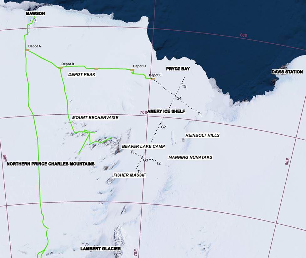
Figure 2 : The Amery Ice Shelf 1968-70 glaciological survey traverses shown by dots; main sledge routes are shown in green.
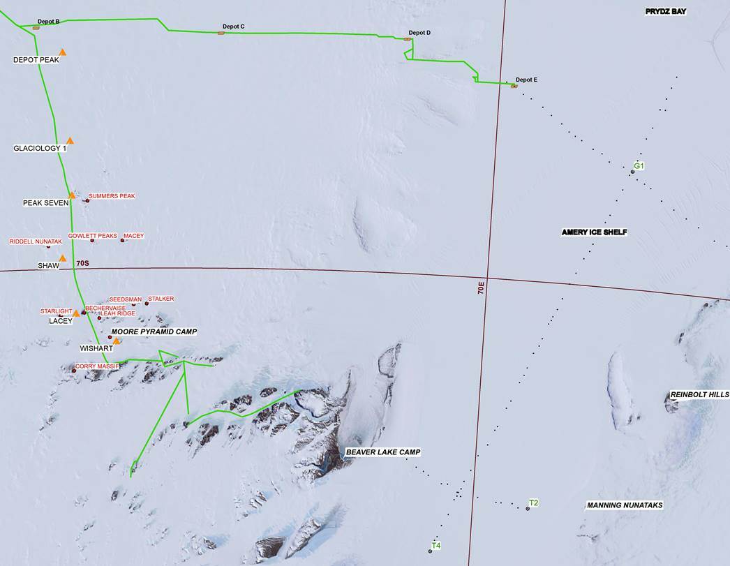
Figure 3 : 1966 extension of the geodetic survey from Depot Peak to Mount Wishart in orange with lower order points shown in red; main sledge routes are shown in green.
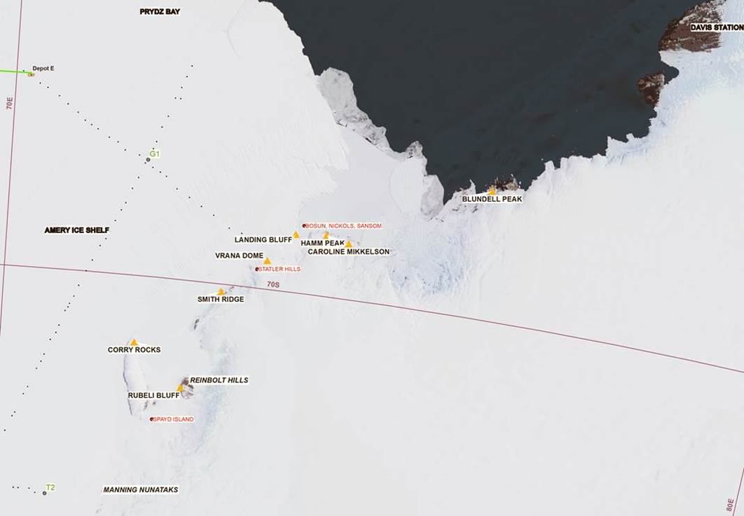
Figure 4 : 1967/68 geodetic traverse to the west of Davis Station from Blundell Peak to Rubeli Bluff in the Reinbolt Hills in orange with lower order points shown in red (Bosun, Sansom and Nickols Islands are too close to show separately at this scale).
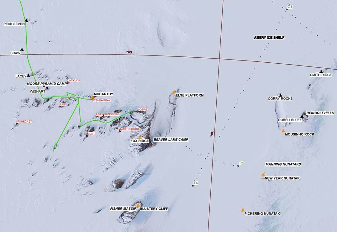
Figure 5 : 1969 section of the geodetic survey from the Reinbolt Hills station of Rubeli Bluff crossing the Lambert Glacier between Pickering Nunatak and Blustery Cliff to the 1966 survey terminal of Mount Wishart, shown in orange; lower order points are shown in red; connections to Else Platform and sites T2 and T4 on the southern end of the Amery Ice Shelf glaciological survey traverses, are also shown.
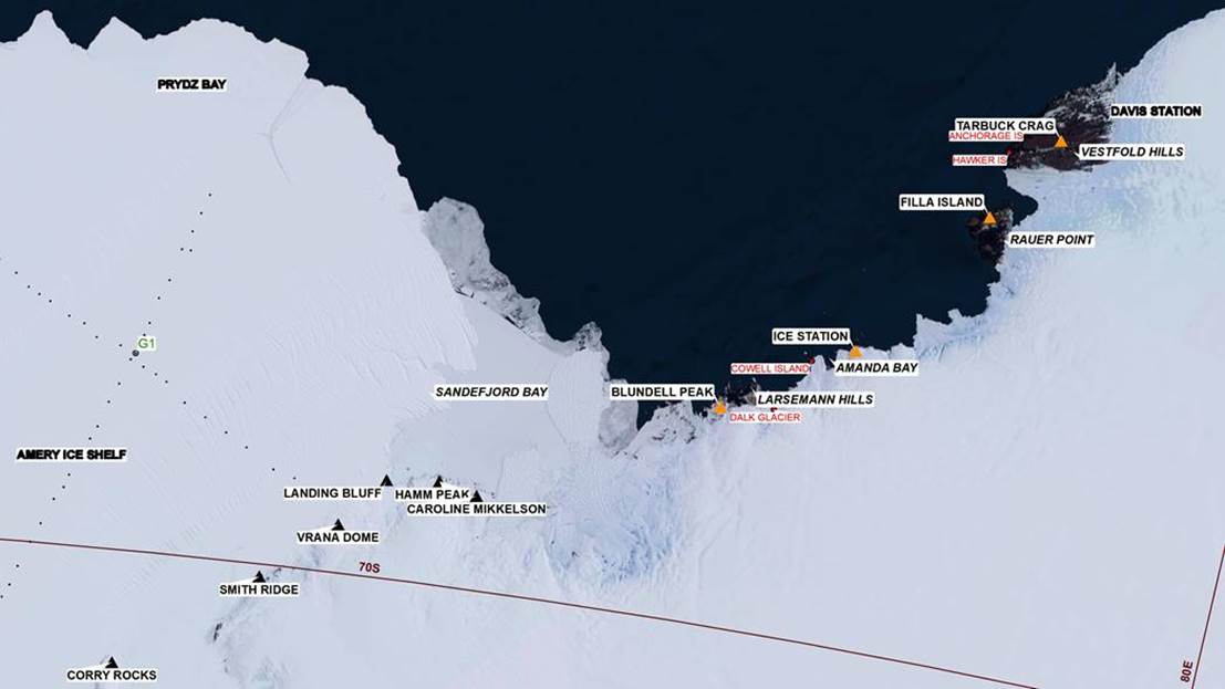
Figure 6 : 1969 section of the geodetic survey from the Larsemann Hills to the Vestfold Hills in the vicinity of Davis Station shown in orange; lower order points are shown in red.
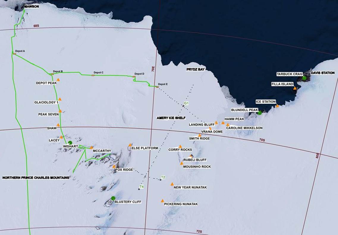
Figure 7 : Depot Peak to Tarbuck Crag section of the continuous tellurometer traverse of 1200 kilometres from Mawson to Davis; the four azimuth control stations are circled in green.
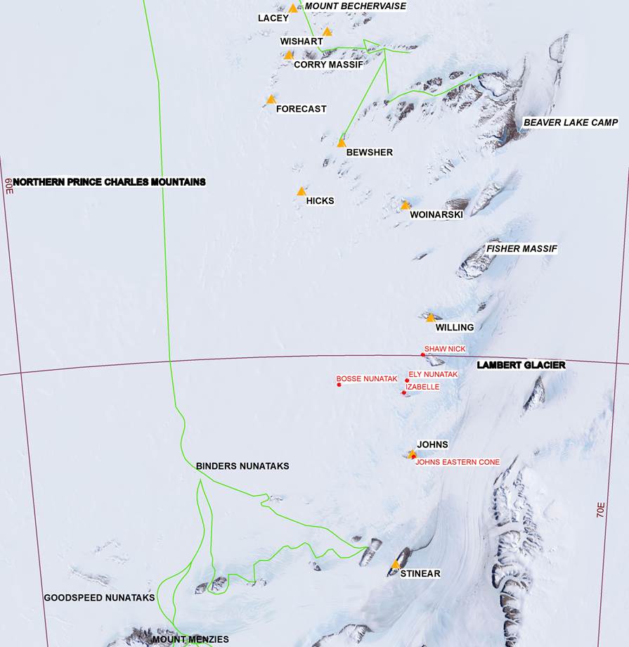
Figure 8 : 1970/1971 survey activity with geodetic stations in orange and lower order points shown in red.
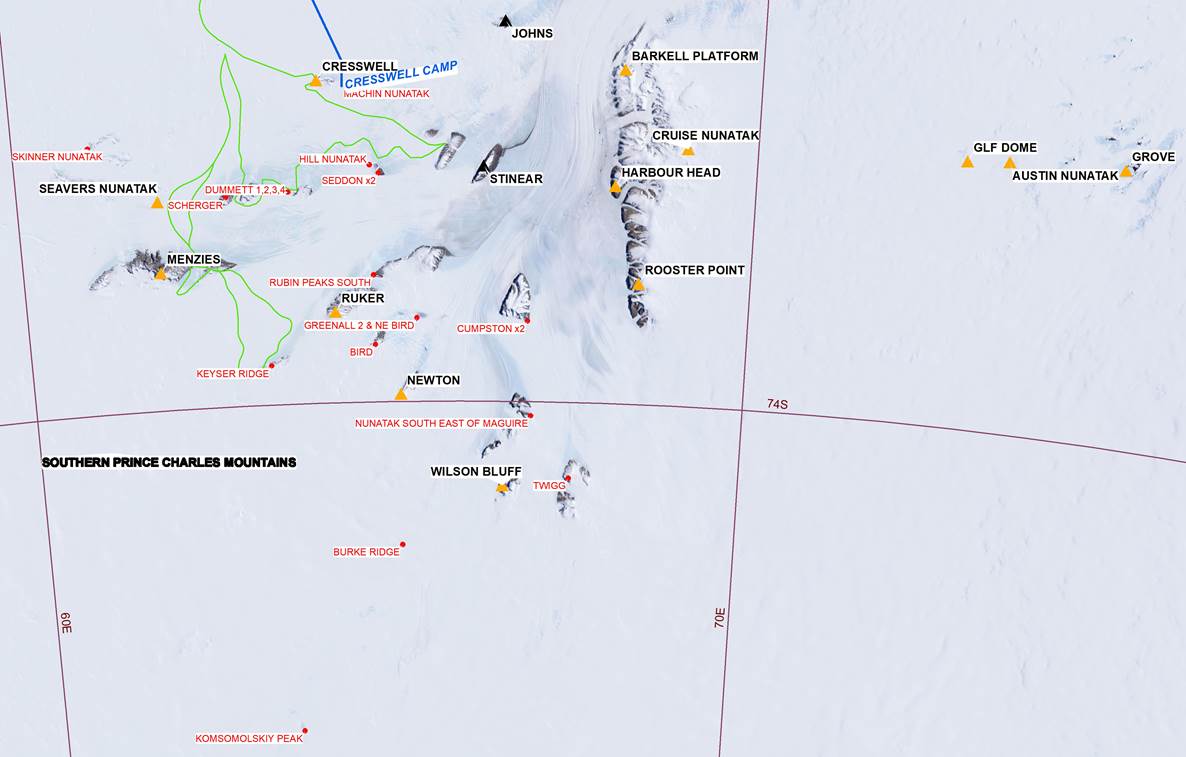
Figure 9 : Shown in orange are the stations of the traverse loop commencing and closing on Mount Cresswell completed during the 1971/72 summer season along with additional geodetic survey points established between 1971 and 1974 including the spur traverse from Rooster Point (NM/S/198) via Cruise Nunatak (NM/S/48), Glf Dome (NM/S/49) and terminating short of the Grove Mountains at Austin Nunatak (NM/S/50). A GPS station was later established in the Grove Mountains; lower order points shown in red (Dummett 1,2,3,4 etc indicates that two or more points are too close to show separately at this scale); blue line is 1970 route taken to establish Cresswell Camp.
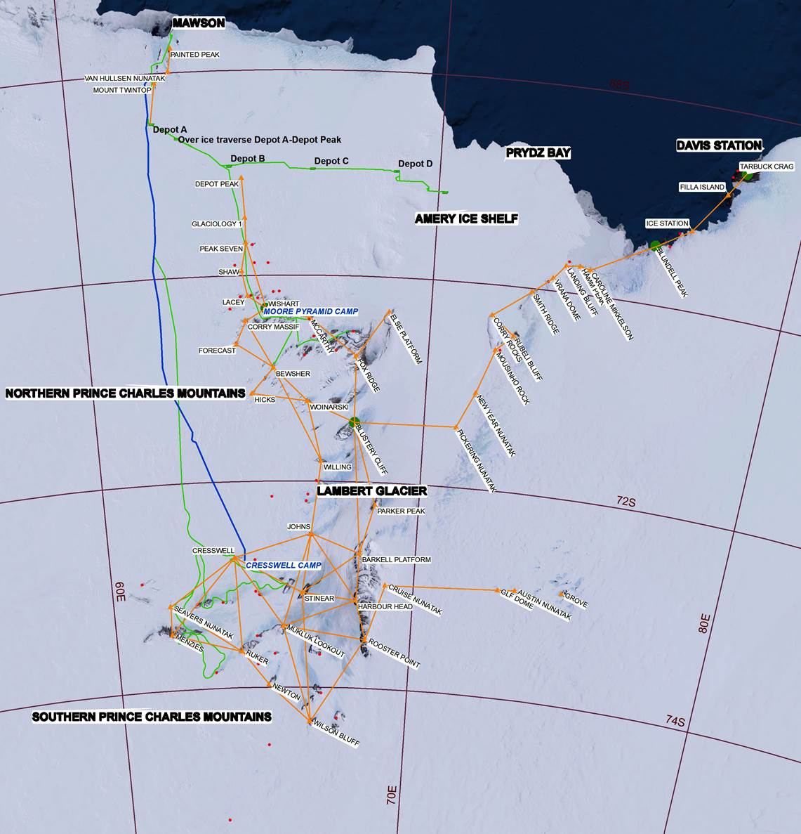
Figure 10 : Extent of the 1965 to 1974 mapping survey work with geodetic points and observed lines in orange (after Figure 4 of Johnston et.al., 2002); lower order points are shown in red; main sledge routes are shown in green; blue line is 1970 route taken to establish Cresswell Camp.
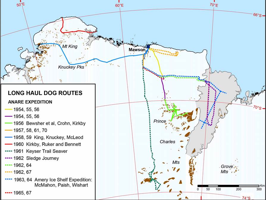
Figure 11 : Map showing extent of dog routes (courtesy Australian Antarctic Division).
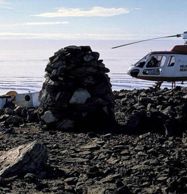
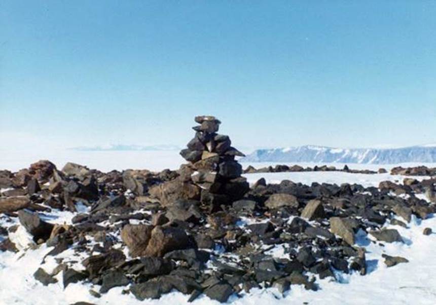
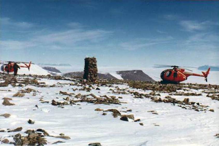
Photographs of some of the survey points in the Prince Charles Mountains
(courtesy Australian Antarctic Division and Xnatmap)
Prince Charles Mountains
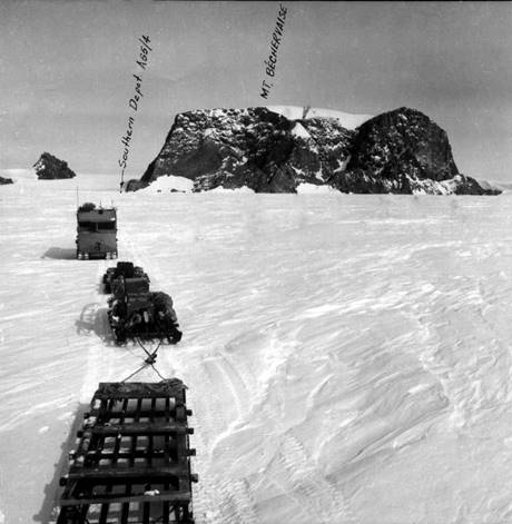
Mount Bechevaise
At Rubeli Bluff
Cairn at Pickering Nunataks looking to west over Lambert Glacier
Cairn at Mount Willing
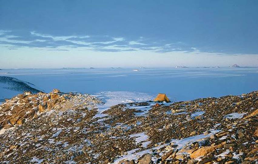
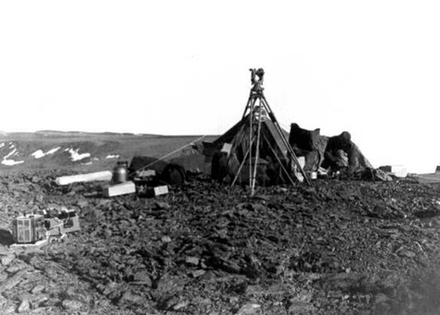
Camp at Mount Woinarski looking north
Cairn at Barkell Platform
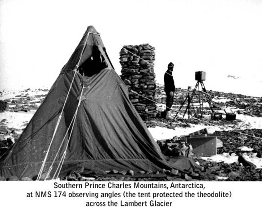
At Barkell Platform (NM/S/174)
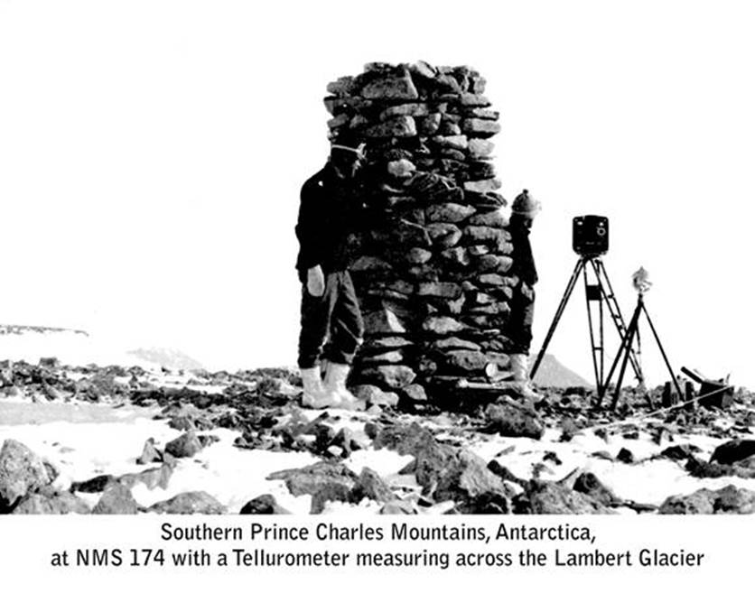
At Barkell Platform (NM/S/174)

Cairn at Mount Johns
Mukluk Lookout
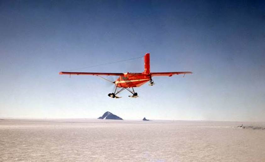
Pilatus Porter with Mount Macey on the horizon
Compiled by Paul Wise, March 2019